Polymer
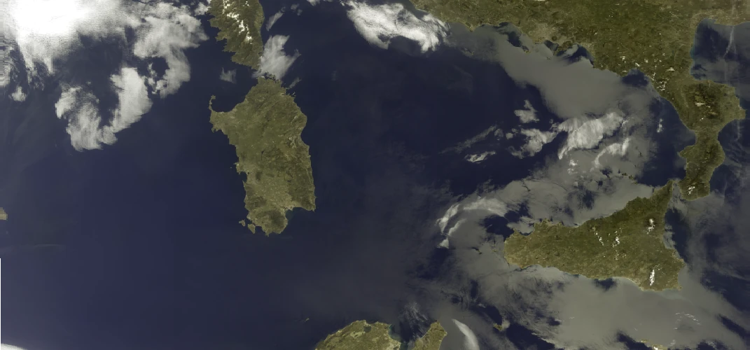
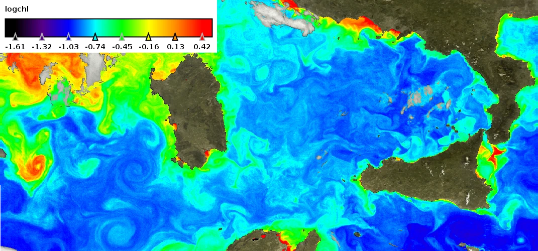
Polymer1 recovers the radiance scattered and absorbed by the oceanic and inland waters from the signal measured by satellite sensors in the visible spectrum. One of the strengths of this algorithm is the possibility to recover the water colour in presence of sun glint. This leads to a much-improved spatial coverage compared to other algorithms.
Polymer is applied to multiple polar-orbiting sensors from ESA (Envisat/MERIS, Sentinel-3/OLCI, Sentinel-2/MSI, …) and NASA (SeaStar/SeaWiFS, Aqua/MODIS, Suomi/VIIRS) and to hyperspectral sensors (PRISMA, HICO). It is used in several Earth Observation projects, by many research institutes, for water quality applications.
Polymer version 5 is currently in development and will be released soon.
Polymer terms and conditions of use are available here.
Contact at HYGEOS: François Steinmetz

(1)Steinmetz, F., P.-Y. Deschamps, and D. Ramon, “Atmospheric correction in presence of sun glint: application to MERIS,” Opt. Express 19, 9783-9800 (2011) https://doi.org/10.1364/OE.19.009783
Polymer is recognized for its high performance and reliability. That’s why it is implemented in the operational processing chains of the Copernicus Marine Service, of the Copernicus Climate Change Service and in the Copernicus Land Monitoring Service to generate near-real-time and/or archive products.

CLS group, a French company providing value-added applications and services based upon satellite data, uses Polymer in CatSat, a worldwide satellite service to help fishing fleets.


Chlorophyll concentration in log10 (mg/m3) (right) derived by Polymer processing from Top-of Atmosphere MERIS reflectance (left) acquired on 1st May 2005 over the Mediterranean Sea. The ocean color information is retrieved even in the sun glint area, the bright reflection of the sun by the sea surface in the right part of the left image.


