SolaRes®
SolaRes® ingests only satellite images and simulation data, without a priori use of in-situ measurements for recalibration purposes, allowing homogeneity in time and space of all outputs.
SolaRes® provides the global horizontal (GHI), global tilted (GTI), and direct normal (DNI) irradiances, and the slant path attenuation (for tower CSPs).
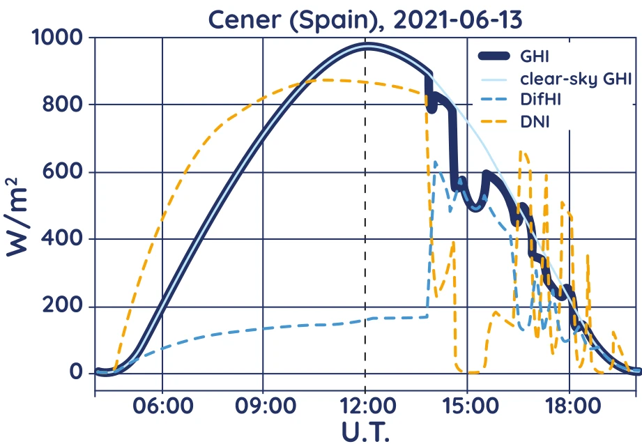
Daily cycle of solar resources on 13th June 2021 at Cener, Spain.

SolaRes® estimates accurately the solar resource thanks to precise and detailed simulations of all physical processes of the radiative transfer performed by the state-of-the-art Monte Carlo method implemented in the SMART-G software which allows fast calculations through massive parallelization using graphic cards.

Architecture of SolaRes®
Consequently, SolaRes® can account for various geometries of solar panels (inclination, shadows, …) with calculations more precise than those based on look-up tables and subsequent interpolations.