ImagineS : Implementing multi-scale agricultural indicators exploiting Sentinels

HYGEOS has coordinated the FP7/ImagineS consortium, gathering 8 European partners, which has performed the Research and Development activities to ensure the continuity of the operations of the Copernicus Global Land Service. Thus, ImagineS has defined the algorithm retrieval of LAI, FAPAR, FCOVER from PROBA-V 300m data. The associated software, developed by HYGEOS, has been qualified in ImagineS before being integrated into the production facilities of the Copernicus Global Land Service. Now, the Collection 300m LAI, FAPAR, FCOVER products are available over the globe from January 2014 onwards every 10 days.
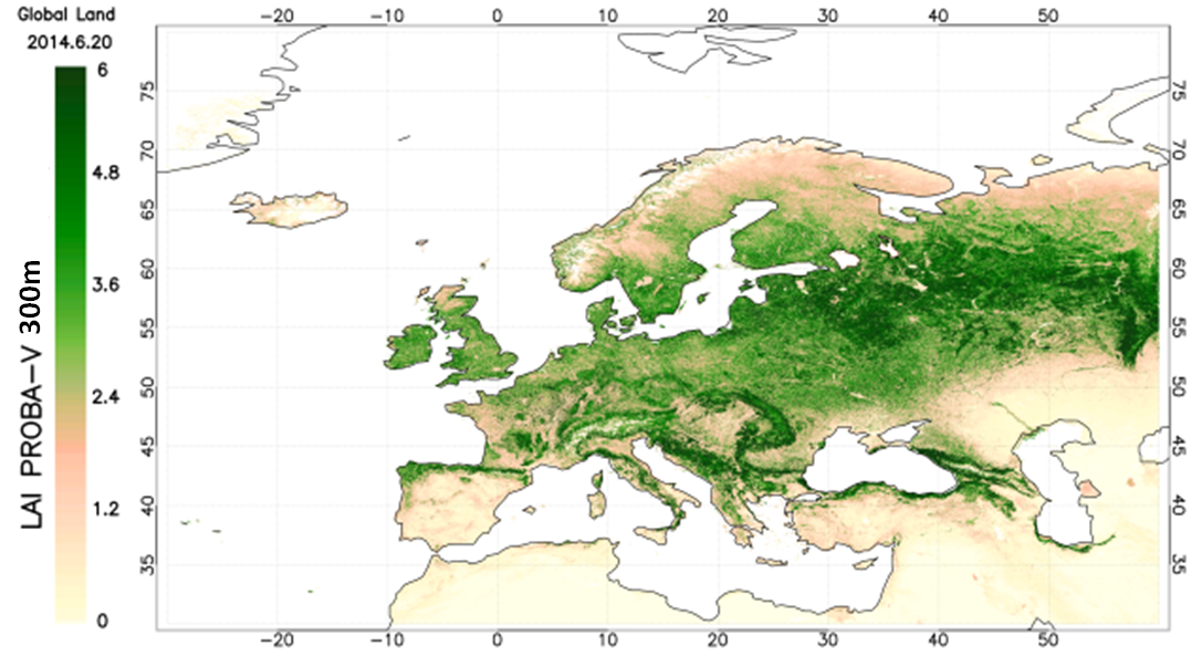
Map of Collection 300m LAI from PROBA-V data, June 2014.
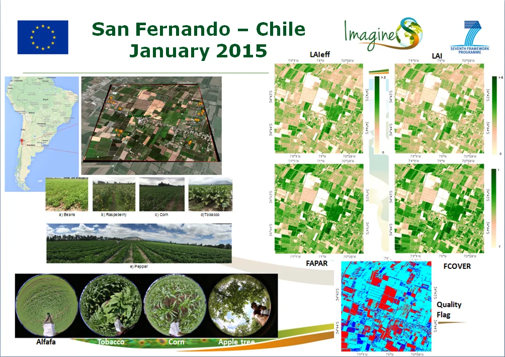
From 2013 to 2016, ImagineS has organized a number of field campaigns. The in-situ measurements were acquired according to the guidelines defined in compliance with the protocols proposed by the CEOS LPV group. The local measurements collected over the main vegetation types of the sites have been up-scaled using high resolution satellite imagery to generate reference maps of LAI, FAPAR and FCOVER. This results in an unique database useful to validate the satellite-derived biophysical products.

Validation site, ground measurements and resulting high resolution reference maps: example of San Fernando, Chile.


In addition, ImagineS has also provided estimates of Net Ecosystem Exchange (NEE), Gross Primary Production (GPP), and Above Ground Biomass (AGB) from Land Data Assimilation System over a selection of sites at global and regional scales.

Details on ImagineS achievements, products and documentation are available on the project website at http://fp7-imagines.eu

Funder : European Commission (EC)

Duration : 2012 – 2016

Contact at HYGEOS : Roselyne Lacaze