METimage Cloud Top Pressure

Context

METimage sensor is intended to provide high quality imagery data for global and regional numerical weather prediction and now-casting, and to support the sounding instruments on EPS-SG. Taking advantage of its large spectral range (0.44-13.5 μm), METimage will provide, among others, cloud top pressure (CTP) products based on the use of visible imaging.

This project aimed to establish the basis of an operational algorithm for the retrieval of CTP from the information supplied by the Oxygen A-band channels of the METimage instrument. HYGEOS managed and contributed mainly to this project which was operated in partnership with the Laboratoire d’Optique Atmosphérique.

HYGEOS Activities

A retrieval method based on optimal estimate approach (see poster) has been designed, prototyped and tested using simulated METimage and real MERIS data. This included the following steps:

  • A sensitivity study and information content analysis corresponding to METimage channels characteristics. This study was necessary to derive an error budget for the retrieved parameters. It was also the starting point for the definition of the forward model to be used in the retrieval.
  • The definition of a pertinent physical forward model and the set of physical parameters that can be retrieved (or only varied during the retrieval: non-retrieved parameters).
  • The computation/optimisation of the corresponding Look-Up Tables to be used as the forward model during the retrieval. For speed reasons, the use of pre-computed results for the forward model was necessary to be compliant with the operational near real time constraints. We needed to define the range and steps of the sampling for each relevant model parameter in order to reach a trade-off between accuracy (degraded due to interpolation) and LUT size.
  • The testing and analysis of the retrieval algorithm on simulated METimage (see 4MSDS) and real MERIS data.
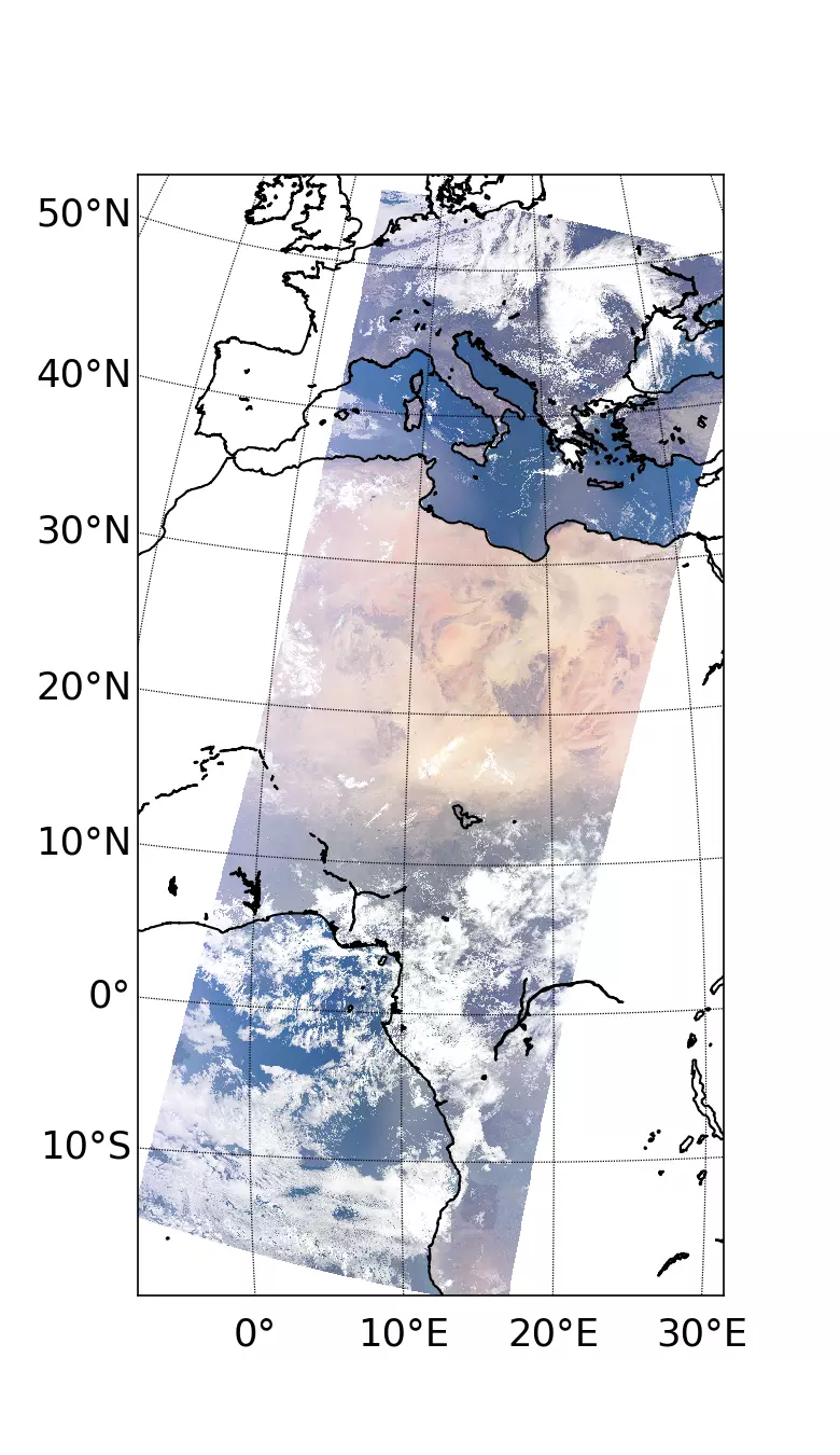
RGB composite (670nm, 555nm, 443nm) from METimage synthetical data
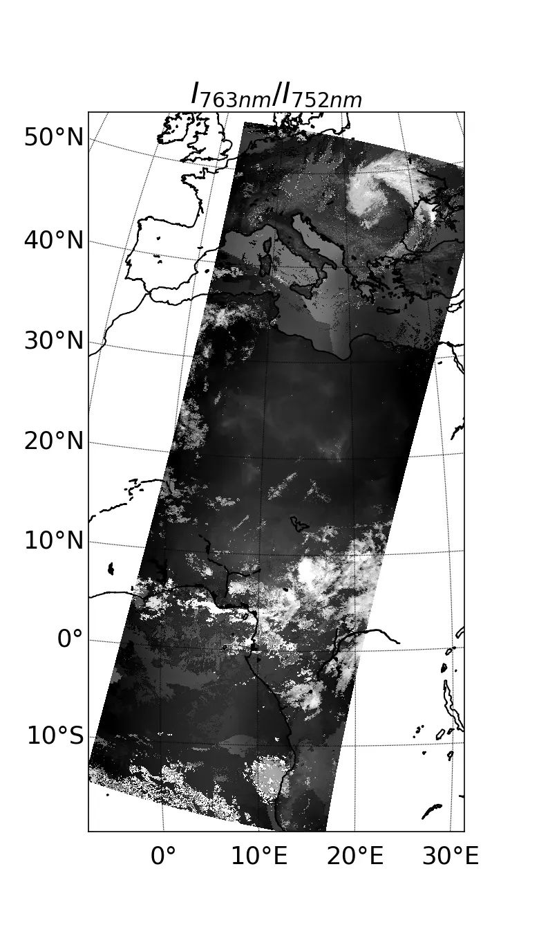
Ratio of simulated METImage radiances at 763 nm and 752 nm.
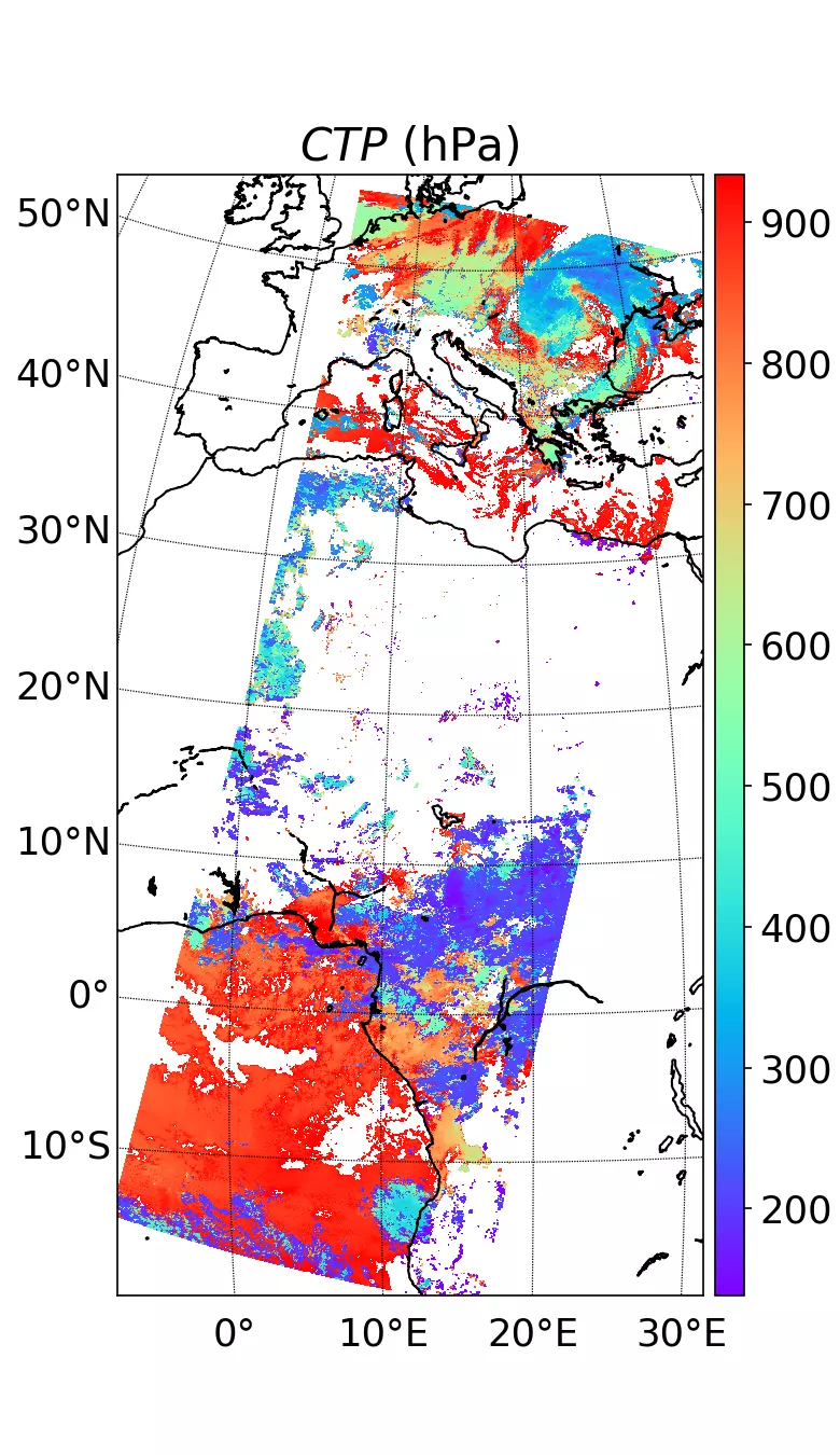
Cloud Top Pressure retrieved from METImage synthetic data

Left panel is a RGB (670nm, 555nm, 443nm) from METimage synthetical data. Middle panel shows the ratio of radiances at 763 and 752 nm. That ratio is the observable from which we retrieve the Cloud Top Pressure shown on the right panel.

Likewise the CTP, the cloud vertical structure has a great impact on the observed radiance in oxygen A-band. Unfortunately, the information content corresponding to METimage characteristics does not allow retrieving it together with the CTP. We needed to fix the cloud vertical structure in the model according to a climatology as a function of CTP and the cloud optical depth. Final users of the CTP product must be informed about the potential error on the retrieved CTP due to departure of the modelled cloud vertical structure regarding the actual one. This error can be great especially in case of multi-layer clouds that are not accounted for in the retrieval. On a second phase of the project, we evaluated the possibility to flag multi-layer situation and, more generally, situation of great discrepancy between the model cloud vertical structure and actual one, by using METimage channels for which the water vapor absorption is significant. Thanks to the different vertical distributions of O2 and H2O, the coupling between cloud scattering and the absorption of those two gases bring some information content about the cloud vertical distribution as long as the vertical distribution of O2 and H2O is known. METimage channels affected by O2 and H2O absorption are exploited to that regard.


Funder : EUMETSAT

Duration : 2015 – 2019

Contact at HYGEOS : Mathieu Compiègne