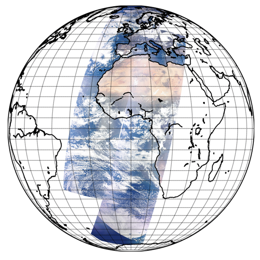
Simulation of satellite data
Space agencies have growing interests in test data for the preparation of future missions. The production of Level 1 data for full observing sequences and covering the diversity of natural targets allows agencies to anticipate the grounds segment exploitation in many aspects (from pixel classification to Level 2 treatments, evaluation of computer resources, etc). Furthermore, it offers to end-users the possibility to get familiar with the data format and information content. The production of TOA radiance with arbitrary spatial and spectral sampling also allows studing the information content in designing new instruments. It is also useful to assess some aspects of instruments calibration (e.g. study the impact of spectral response function mis-characterisation on Level 2 products).
Thanks to its in-depth knowledge of the radiative transfer, HYGEOS has developed powerful and accurate tools. Using the satellite radiances simulator, SMART-G and SMAC-CL, HYGEOS can simulate data for any existing or future passive radiometer flying onboard polar-orbiting or geostationary Earth Observation platforms. Thus, HYGEOS offers services to:
- Review and specify needs for future missions
- Qualify the design of new missions
- Quantify performance of space instruments and missions
- Mimic the satellite sensor acquisitions for validating on-board and ground processing algorithms
Satellite radiance simulator
The satellite radiances simulator was developed in collaboration with the Laboratoire d’Optique Atmosphérique and the ICARE Data and Service Center through several EUMETSAT projects. Based on (i) an instrument spectral sampling specification and (ii) a view and spatial sampling specification, pixel based scenes are defined from ancillary data (e.g. CAMS aerosols profiles, ECMWF atmospheric and cloud profiles, MODIS BRDF products). Then, the TOA radiance is computed for each pixel assuming a 1D pixel independent radiative transfer. Two different radiative transfer tools are plugged-in to the simulator:
- RTTOV (Radiative Transfer for TOVS) is a very fast radiative transfer model. It is very efficient in thermal infrared to microwave spectral range of downward-viewing satellite radiometers, spectrometers and interferometers.
- ARTDECO is a numerical tool that gathers models and data for the 1D simulation of Earth atmosphere radiances and radiative fluxes. It is well adapted for the ultra-violet to shortwave infrared spectral regions. Full atmosphere-surface coupling and the polarization are accounted for.
To solve the radiative transfer in UV-SWIR spectral range with a proper absorption/multiple scattering coupling is quite CPU demanding. In order to produce representative sets of Level 1 data (i.e. several orbits) for an instrument keeping the approach of solving the radiative transfer for all pixels, the simulator was designed to be deployed on large computation facilities.
HYGEOS projects involving the simulator:
- CO2M MAP and CLIM Top-Of-Atmosphere simulations
- High Spectral Resolution synthetic radiances for Geostationary imagers
- 3MI cloud algorithm development support
- O2 A-band Cloud top Pressure retrieval with METimage
- Test data for EPS-SG MetImage and 3MI (4M-SDS)
Contact at HYGEOS: Mathieu Compiègne

